Active EM Data Examples
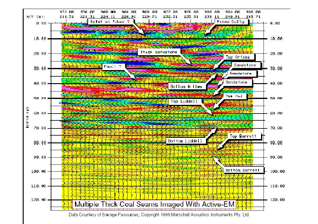
The Marschall Acoustics Instruments Pty. Ltd. Active EM subsurface imaging system is capable of accurately imaging through multiple coal seams. In this example, five (5) coal seams, some quite thick, were imaged simultaneously. Vertical scale is in meters. Deeper targets can be imaged using different data acquisition geometries.
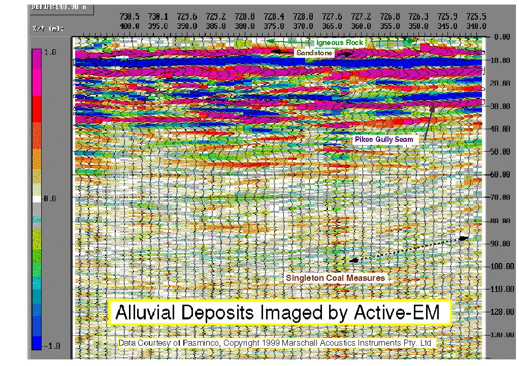
This example shows Active-EM data for a region of coal bearing sedimentary
rock overlain by a layer of volcanic alluvial deposits. Previous
attempts to determine stratigraphy using seismic, GPR, and even drilling
were largely unsuccessful. Active-EM punches through to image even
"bad" data areas. Saline water table is perched on top of first sandstone
layer at base of igneous gravels. Vertical scale is in meters.

Watch this space for upcoming images of metallic minerals, mineral sands, opals, mine headings, voids in blasted rock, and petroleum !
